
Prosiect Gwreiddiau
Roots Project
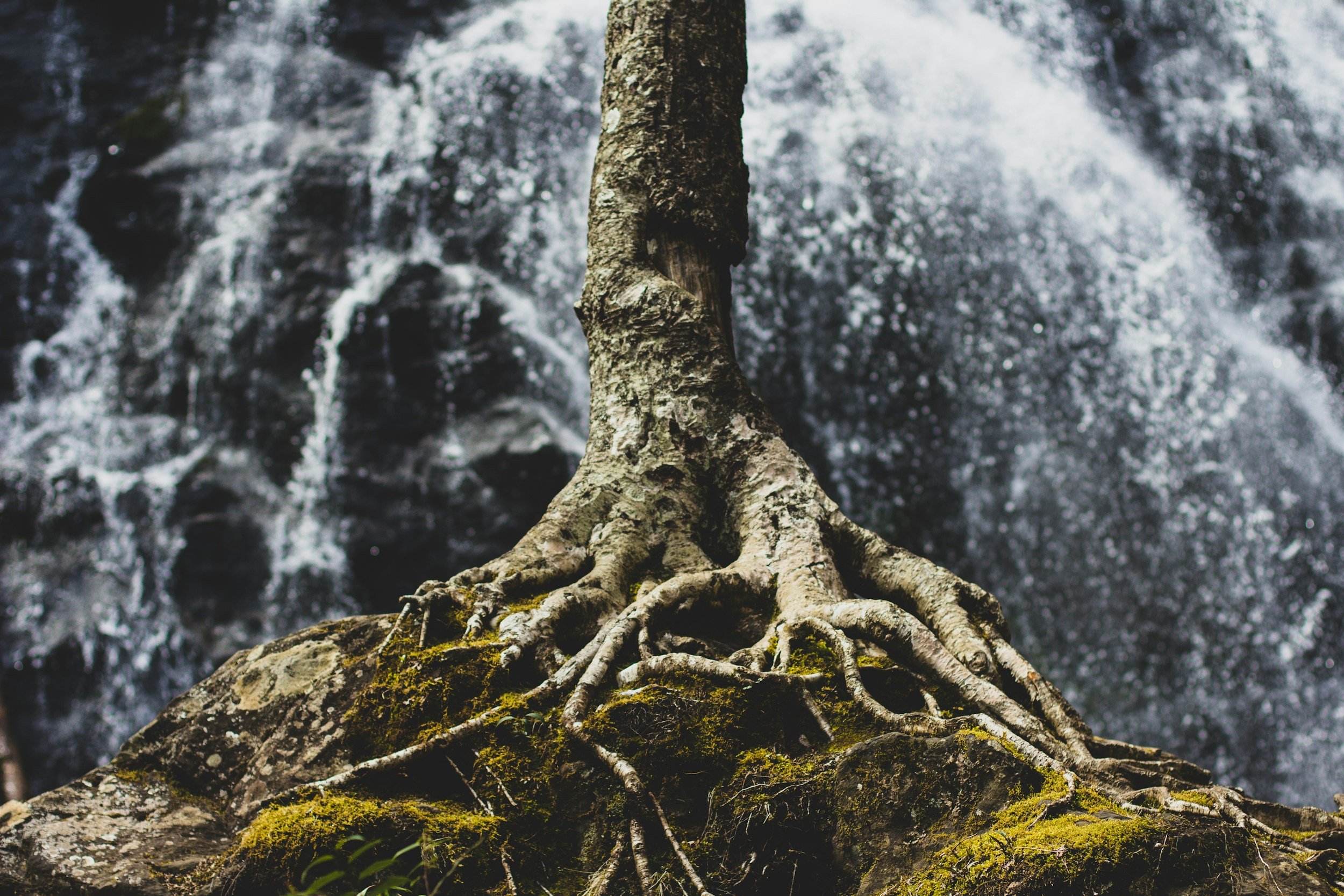
Deep connections
In North Wales, nestled between the rugged uplands and the dynamic coastline, lies a tapestry of ecosystems shaped by centuries of coexistence between nature and humanity.
Here, the roots run deep, not only in the rich soil, plants and rivers, but also in the cultural heritage and traditions that have shaped these communities for generations.


•
464 participants
•
12 schools
•
19 workshops
•
8 upland farmers
•
13 Community groups
•
312 pieces of Citizen Science data
•
6 drop in sessions
•
1 University
• 464 participants • 12 schools • 19 workshops • 8 upland farmers • 13 Community groups • 312 pieces of Citizen Science data • 6 drop in sessions • 1 University

The Study
This project focuses on engaging both urban and rural communities to uncover their profound connections to land and water. We are investigating freshwater root systems and nature-based solutions to enhance freshwater ecosystems and reduce the impact of flooding.
Our initiatives aim to connect new groups and individuals to these vital waterways, fostering a deeper appreciation and understanding.
We are currently, in phase two of the project, where we are developing our Watershed Blueprint by trialing and analysing a series of community-led pilot schemes, ranging from biochar to bivalves. This blueprint also includes exploring the feasibility of granting legal rights to the river, akin to the rights held by citizens and incentives for the community to take part in community wide SUDS tax programmes.
Through inspiring stories and lived experiences, we are empowering communities to lead the effort to protect these river systems.
Objectives
-
Better understanding our communities through data and knowledge share.
Pilot creative ways to engage new groups and individuals.
Provide training for the community to take action
-
Mapping the baseline data and working with the community to 'fill the gaps'
Feasibility studies for catchment interventions
Trialing and implementing a series of innovative ways to improve water quality.
Developing community circular economy opportunities.
-
Implementing Natural Flood Management
Plan of action to trial circular economy initiatives.
Establishing legal rights for the rivers.
THE PLACE
The Interwoven Legacy of the Ogwen and Cegin Rivers
The heritage of these communities is rooted in the slate industry specifically the Penrhyn quarry which connects the Ogwen and the Cegin rivers.
Nestled between two vital river systems, the Ogwen and the Cegin, this area has been shaped by generations of hardworking communities whose lives are intertwined with the slate industry.
This trail not only connected quarries and industries but also wove together the stories and livelihoods of those who called this place home.
We are delving into the deep-rooted history and vibrant narratives that define this unique landscape, where the past merges seamlessly with the present, offering insights into resilience, industry, and the enduring bond between people and place. Below Eilwen tells us about life in a mining family.

Mapping the Data
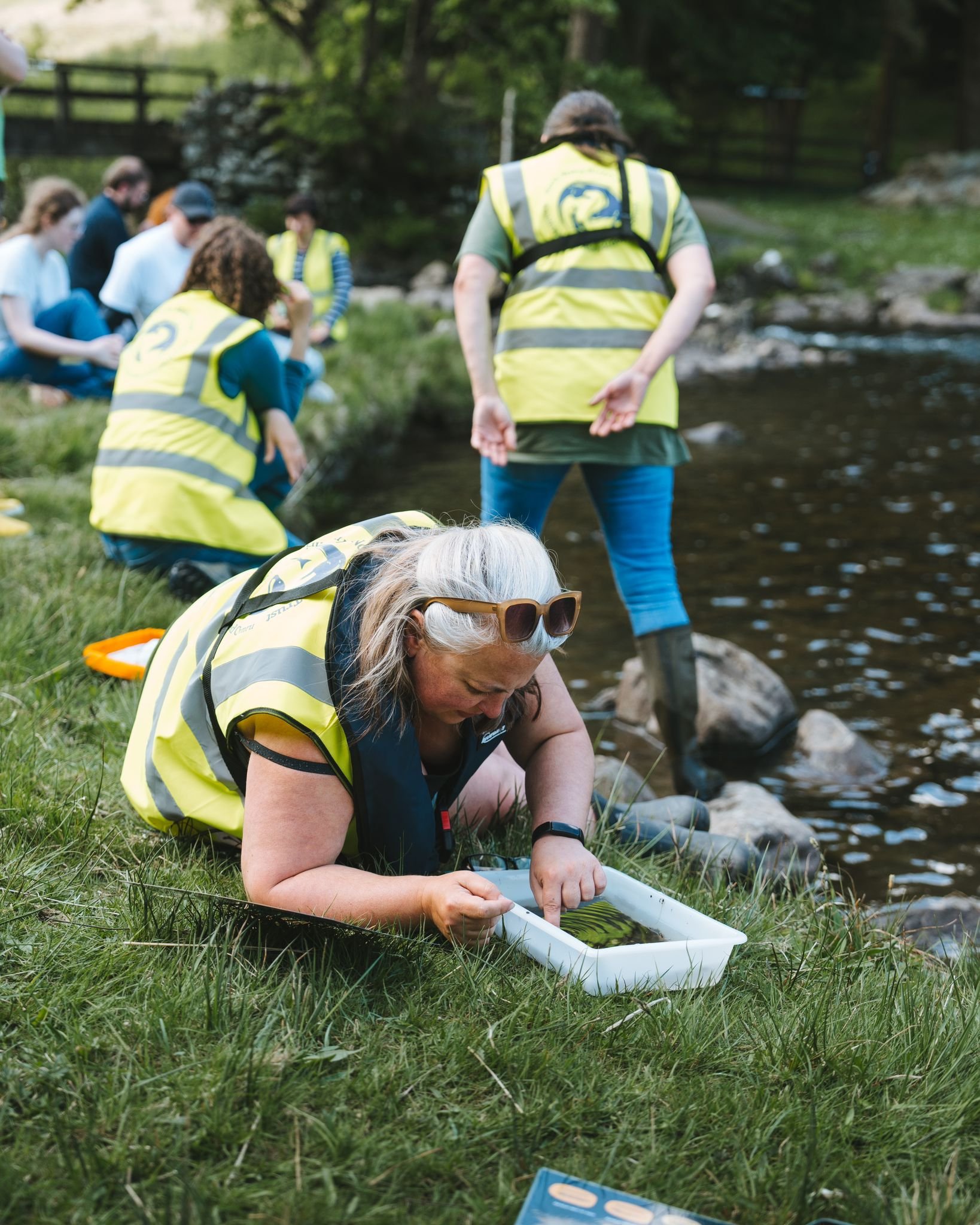
Through training the community in GIS and conducting surveys, we have gathered real-time data to assess the river's state and identify issues. This participatory approach engages the community directly in environmental monitoring.
Utilising Baseline Data
Using government baseline data, we have mapped potential Natural Flood Management (NFM) interventions to improve water quality. This data provides valuable insights into the challenges facing our rivers.
Holistic Community Understanding
We also used government data to understand our communities comprehensively, identifying barriers to well-being and finding ways to improve lives through nature connection and proactive measures.
Action and Empowerment
Combining real-time data, government insights, and community input, we empower communities with the tools and knowledge to improve their environment and enhance their quality of life.

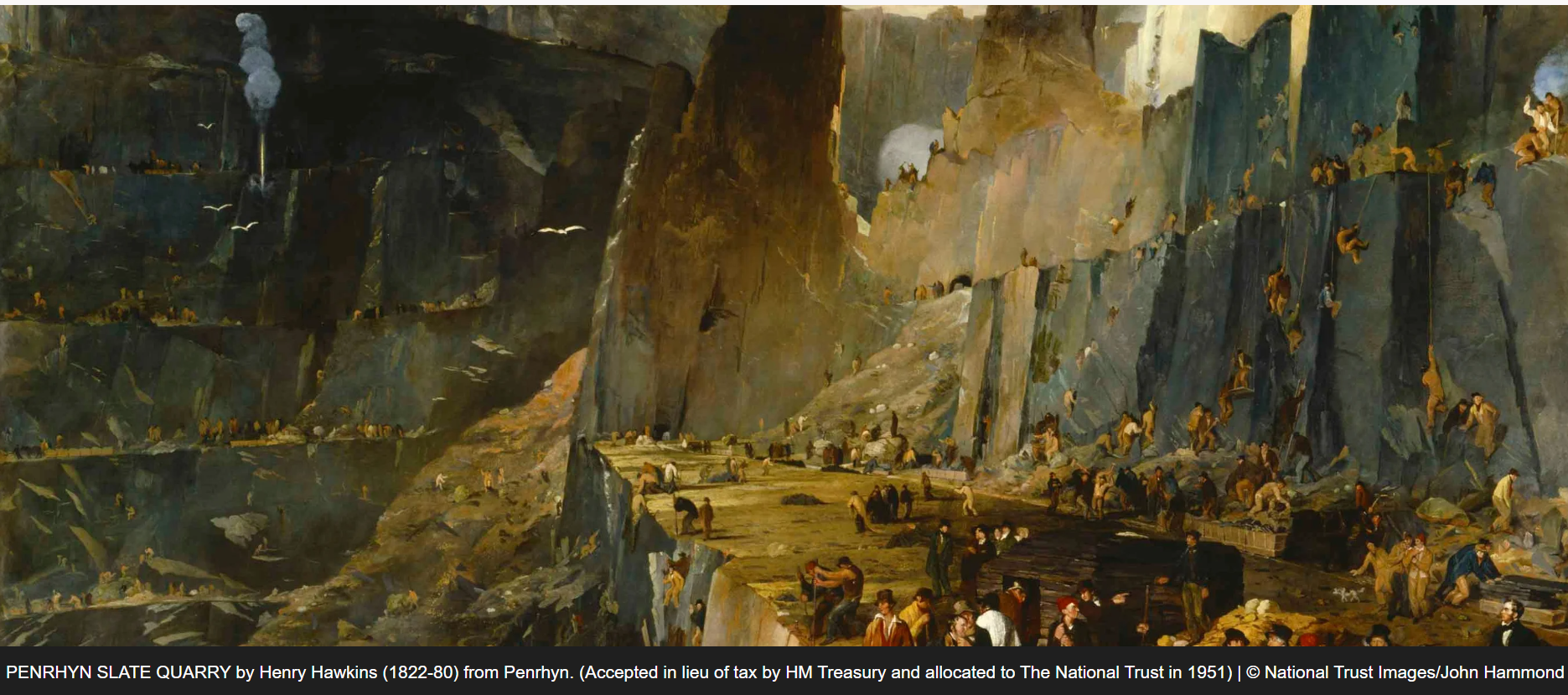
Echoes of Slate: The Heritage and Impact of the Slate Industry on Our Community
By the 1890s, the Welsh slate industry employed approximately 17,000 workers and produced almost 500,000 tonnes of slate a year, around a third of all roofing slate used in the world in the late 19th century.
In the uplands of Mynydd Llandegai you will find the quarrymens cottages, along side the Cegin you will find the old railway remnants and at the final end you will find Penrhyn Castle. Home to the owners of Penrhyn slate quarry.
The dominating stone façade of Penrhyn Castle hides more than just its internal red-brick construction. Built in the early 19th century, its formidable architecture, opulent interiors and fine art collection lean on a long history of sugar and slate fortunes, social unrest and the longest-running industrial dispute in British history.

Risks to the Rivers
Climate change is rapidly worsening river pollution and intensifying problems like invasive species, algal blooms, dead zones, and flooding.
The growing population's water demand exacerbates water abstraction, leading to severe droughts. Water demand in our urban areas has increased by 80% in the last 20 years, causing significant river depletion during heatwaves.
Climate change has increased the frequency of heavy rainfall events by 30%, resulting in devastating floods that destroy homes, disrupt livelihoods, and devastate wildlife habitats.
Water Management/hydrological change: Sustainable water management is crucial for both environmental conservation and meeting the needs of local communities. Issues such as water pollution, over-obstraction, canalisation, and changes in precipitation patterns can impact water resources and the ecosystems that rely on access to clean water.
Intensive land management: Reduced biodiversity and ecological productivity can result from intensive land management practices. Overgrazing, increased use of fertilisers, water pollution/ increased phosphate levels and soil degradation are some of the negative impacts as a result.
The Data Is Stark
The State of Nature Report 2023 for Wales highlights the uniqueness and fragility of Welsh biodiversity. The report indicates concerning trends in biodiversity loss. The Biodiversity Intactness Index for Wales stands at 37%, indicating significant alteration and depletion of species abundance and composition, ranking among the lowest globally. This decline in biodiversity has repercussions for human well-being, including impacts on health, adaptation costs, and loss of ecosystem services.
In addition, the State of Natural Resources Report (SoNaRR) assembled by Natural Resources Wales in 2020 discusses the importance of living as one – where the wellbeing of both people and the planet exist alongside each other and complement one another. This intertwines with the Welsh Government’s Well-being of Future Generations and Environment Act.
We are also experiencing more frequent floods, droughts, and other extreme weather events due to climate change. These events not only disrupt ecosystems, but also threaten the biodiversity that relies on stable and healthy habitats, livelihoods, food security and homes.
Salmon and sea trout (sewin) are both iconic species in Wales, requiring high quality freshwater habitats to thrive and are a key indicator of the environmental quality of river catchments, while also providing important opportunities for healthy and valuable recreation.
Wales has 23 principal salmon river catchments for which stock assessments are undertaken and reported upon annually. The results from the latest assessment have shown that 91%, 21 salmon rivers in Wales are now categorised as being At Risk, and 9% Probably at Risk. No rivers were categorised Not at Risk or Probably Not at Risk.
In addition, Wales has 33 main sea trout rivers – No rivers classed as ‘Not at Risk’ , four rivers (12%) as Probably Not at Risk , eight rivers (24%) as Probably at Risk and 21 rivers (64%) as At Risk.
Migratory fish populations have crashed by more than 80% since 1970. 75% of freshwater fish have become extinct since 1970.
Dams, mining and humans diverting water are destroying river ecosystems. In Europe, populations of migratory freshwater fishes have fallen by 75%, according to the latest update to the Living Planet Index.
Migratory freshwater fish partially or exclusively rely on freshwater systems – some are born at sea and migrate back into fresh water, or vice versa. They can in some cases swim the width of entire continents and then return to the stream in which they were born.
Prioritising river protection, restoration and connectivity is key to safeguarding these species.

The Impact of Land Use on River Ecosystems
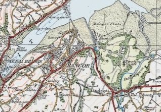
Land use has a profound impact on river ecosystems, shaping their health and functionality over time. Human activities such as agriculture, urban development, and industrial processes have significantly altered the natural landscape, affecting rivers in multiple ways. The two maps below show the same area of Bangor from 1922 to the present day. You can see as the population has grown and so has the concrete and impermeable surfaces.

The planet is warming at an unprecedented rate. As a result, sea levels have risen faster over the past 100 years than they have for at least 3,000 years, and the frequency and intensity of heavy precipitation events have increased.
We've also damaged Wales’ resilience to flooding by degrading the environment. By draining peat bogs, removing hedgerows, destroying salt marshes, concreting green spaces and building on flood plains, we've undermined the ability of the natural environment to cope.
The weather is becoming windier, wetter and wilder around the world as climate scientists have predicted and Wales is becoming more prone to extreme weather events. In the past decade we have seen more flooding, both in our cities and in the countryside, whether from intense rainfall, increased river flow or sea surges. Even with advance warning systems in place and improved flood defences, we need to become much more resilient to flooding and make use of a broader suite of flood management tools and the planning system to address risk.
Research for Friends of the Earth by the University of Manchester has identified that over 700,000 people in the 10% most socially vulnerable neighbourhoods are at risk of river, coastal, or surface water flooding because of their location and a probable lack of flood defences, with people of colour disproportionately affected.
The reality is poorer households are less able to invest in their properties to make them more flood resistant (e.g., flood gates) and resilient (e.g., easier to clean and dry out). Some are less able to respond when flooding occurs, like those who are disabled or frail due to age or illness. And many are unable to bounce back after floods - around 50% of all renters may not have home contents insurance , and this rises to 61% of low-income renters .
“Climate change is happening now. It's happening faster than we thought it would, and it's more severe than we thought it would be.”
— James Hansen, Climatologist

In this catchment there were 23,990 sewage spills equating to spilling for 26 years, 2 months & 27 days.
The Cegin alone spilled for for 28 days in one year.
— Source The Rivers Trust

Voices Of The Water
Local residents share their stories, revealing the deep connections to the river and
significant impacts that climate change and pollution has had on their communities.
Reviving Rivers Through
Transformative Engagement
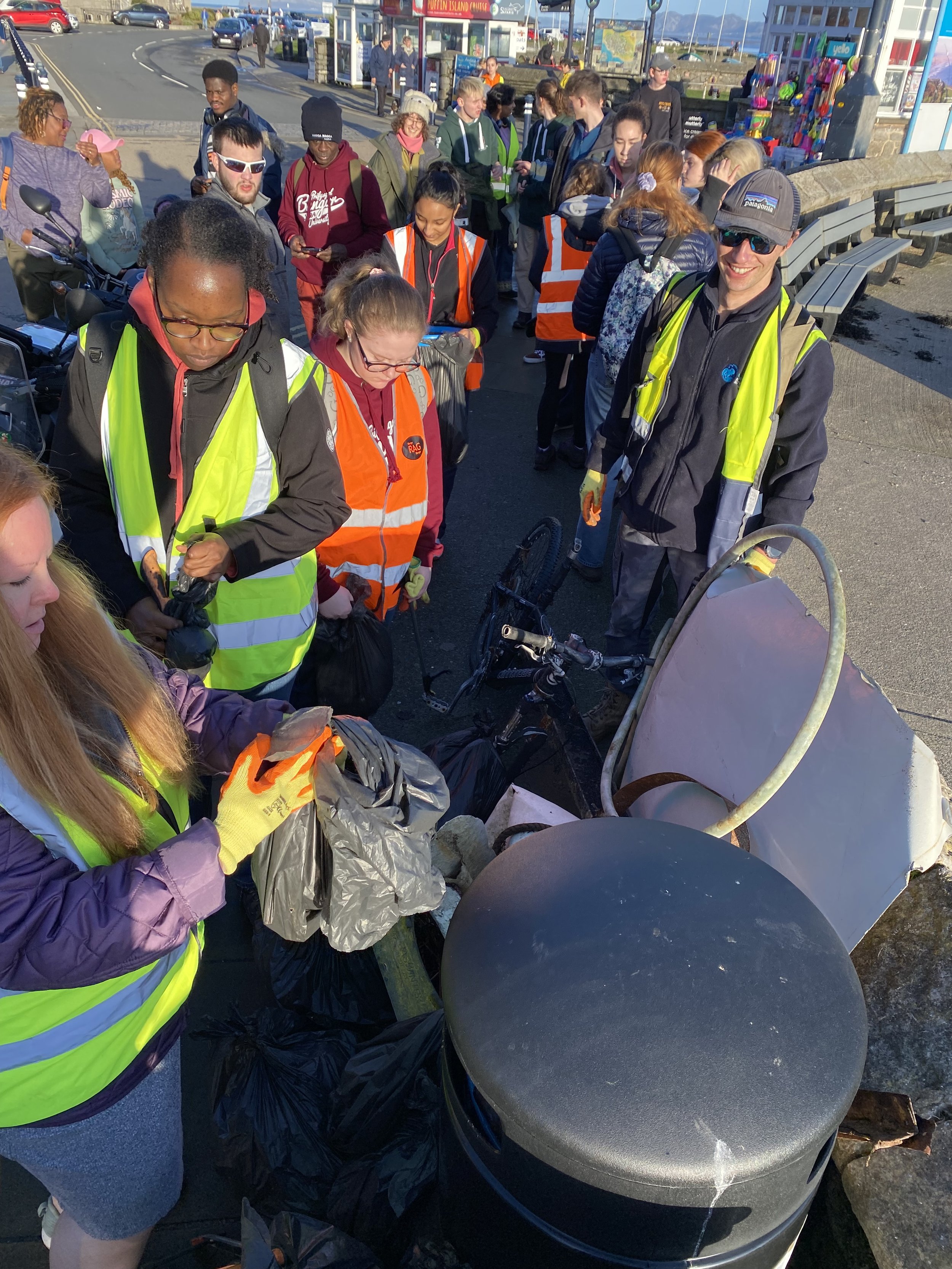
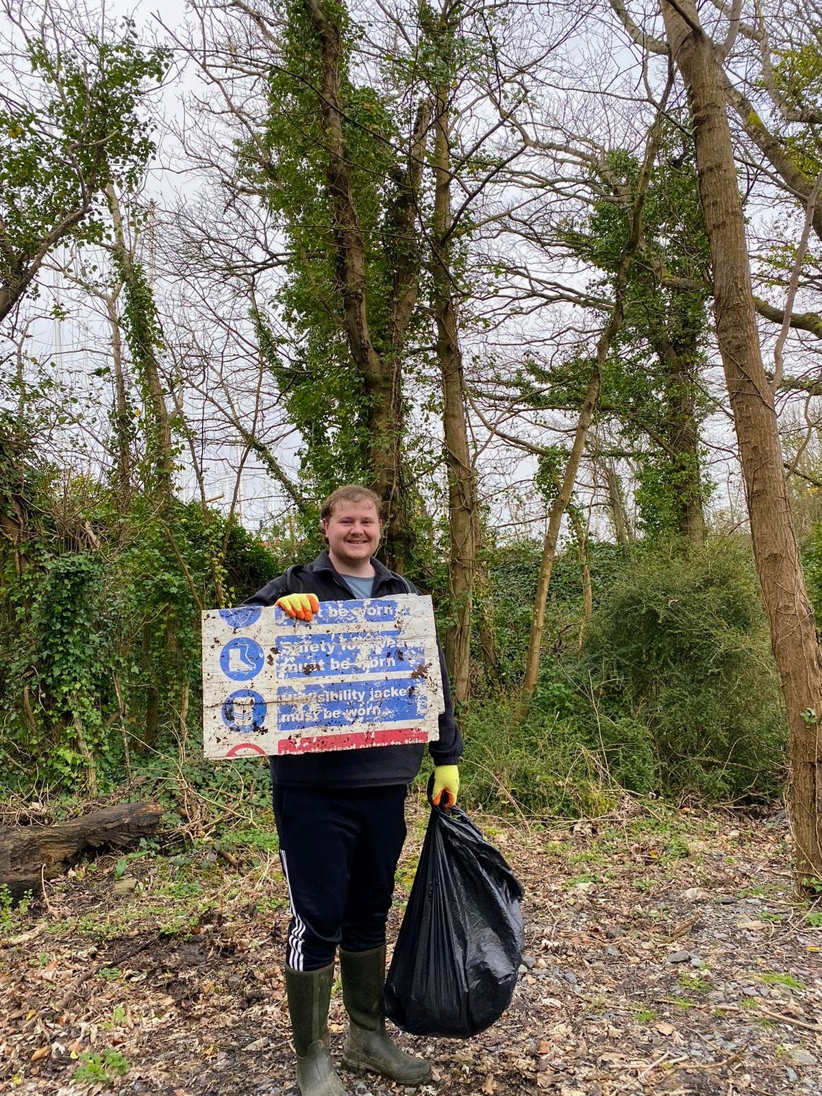
In our efforts to reconnect communities with their local rivers, we focused on engaging those who have not traditionally been involved in environmental activities.
By employing innovative and creative approaches, we aimed to ignite interest and foster a deeper appreciation for these crucial waterways. Recognising that meaningful change requires the participation of everyone.
We tailored our initiatives to ensure that all voices are heard and all hands are involved in the stewardship of our rivers
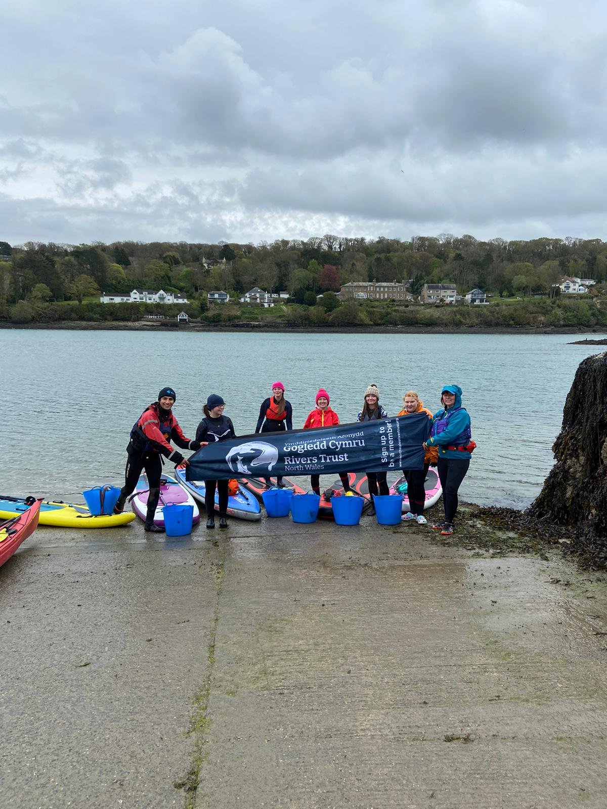
Uplands to the Sea Field Visit
We invited members of the community to join us on a field trip from the uplands to the sea. The aim of the day was to demonstrate a catchment based approach. Showcasing the issues facing rivers and landscapes from the uplands to the sea and becoming more frequent with climate-related challenges.
We concluded the trip in Eryri, near the upland community of Mynydd Llandegai, which is experiencing a significant increase in rainfall causing flooding. We stopped at one of our landowners' farms in Nant Peris to assess soil health and infiltration levels. We visited Llyn Padarn to learn about the impact of pollution on the Eryri Torgoch populations. Before heading to the Cegin for a river walk and discussion about urban pollutants and Sustainable Urban Drainage Systems (SUDS). We stopped off at the Menai Seafood Company, which relies on freshwater quality for its business. We ended the visit in the Menai Strait on a boat ride to examine the impact of 13 freshwater rivers on the coastal habitats and industries operating there.
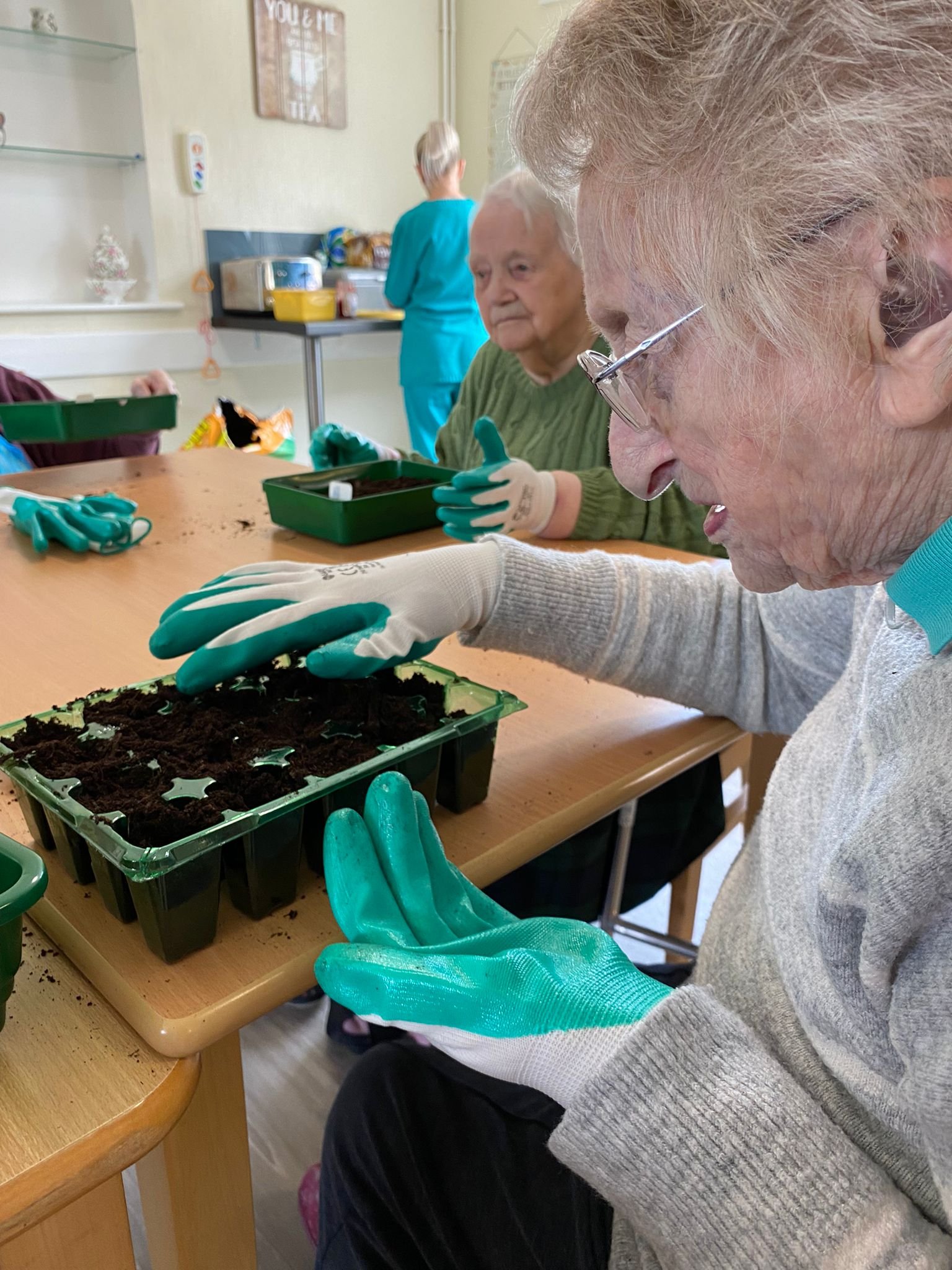
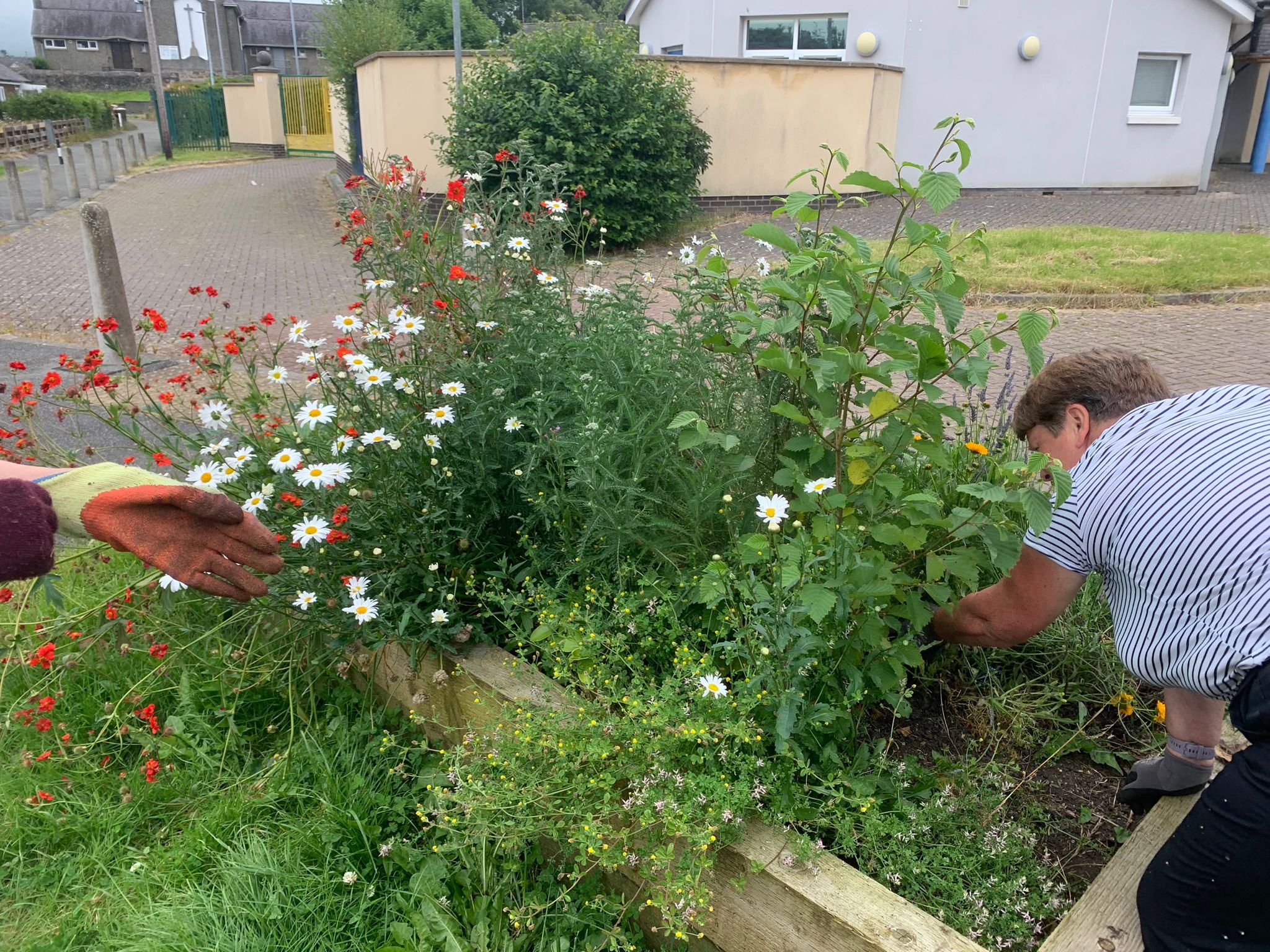
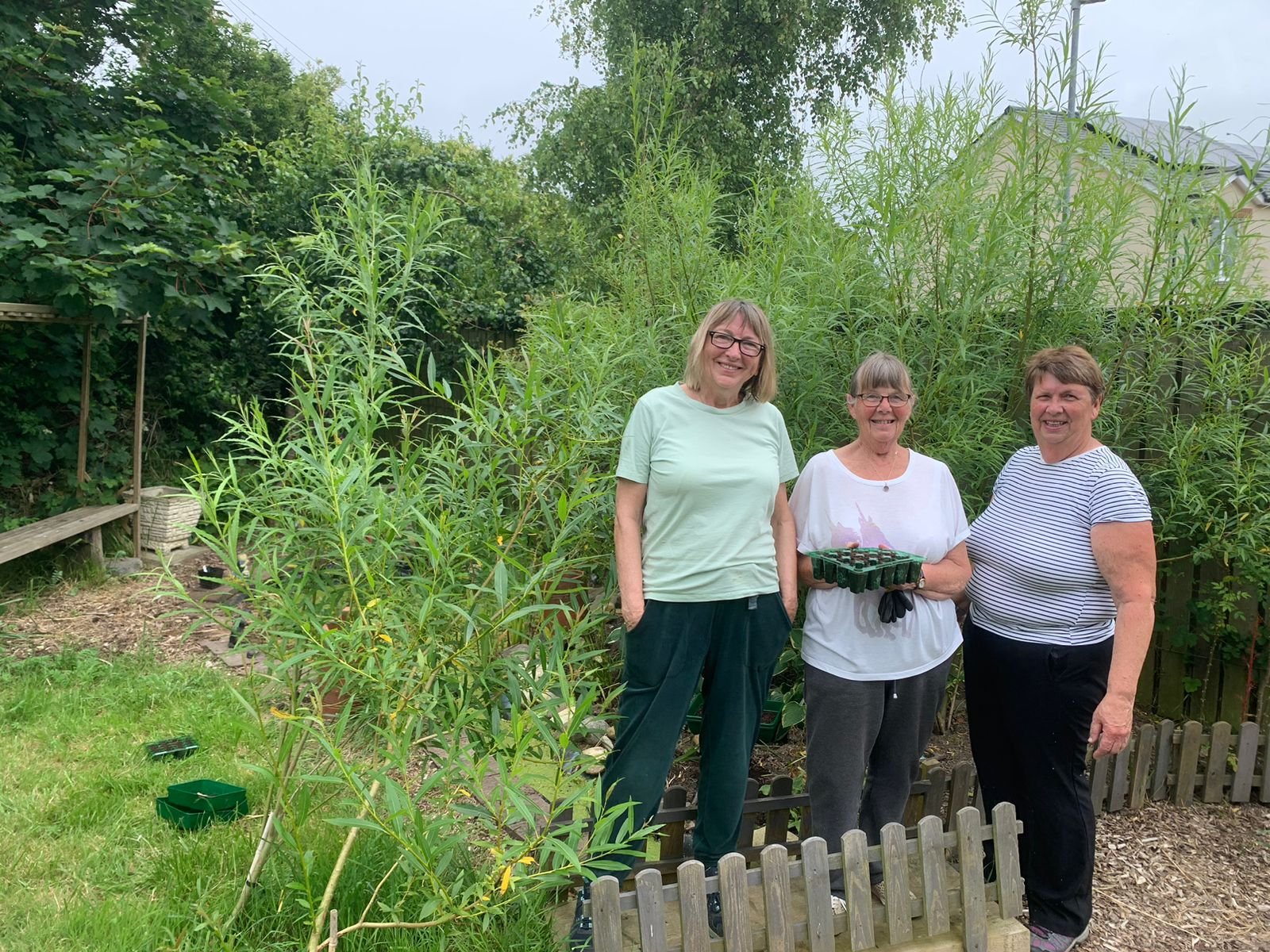
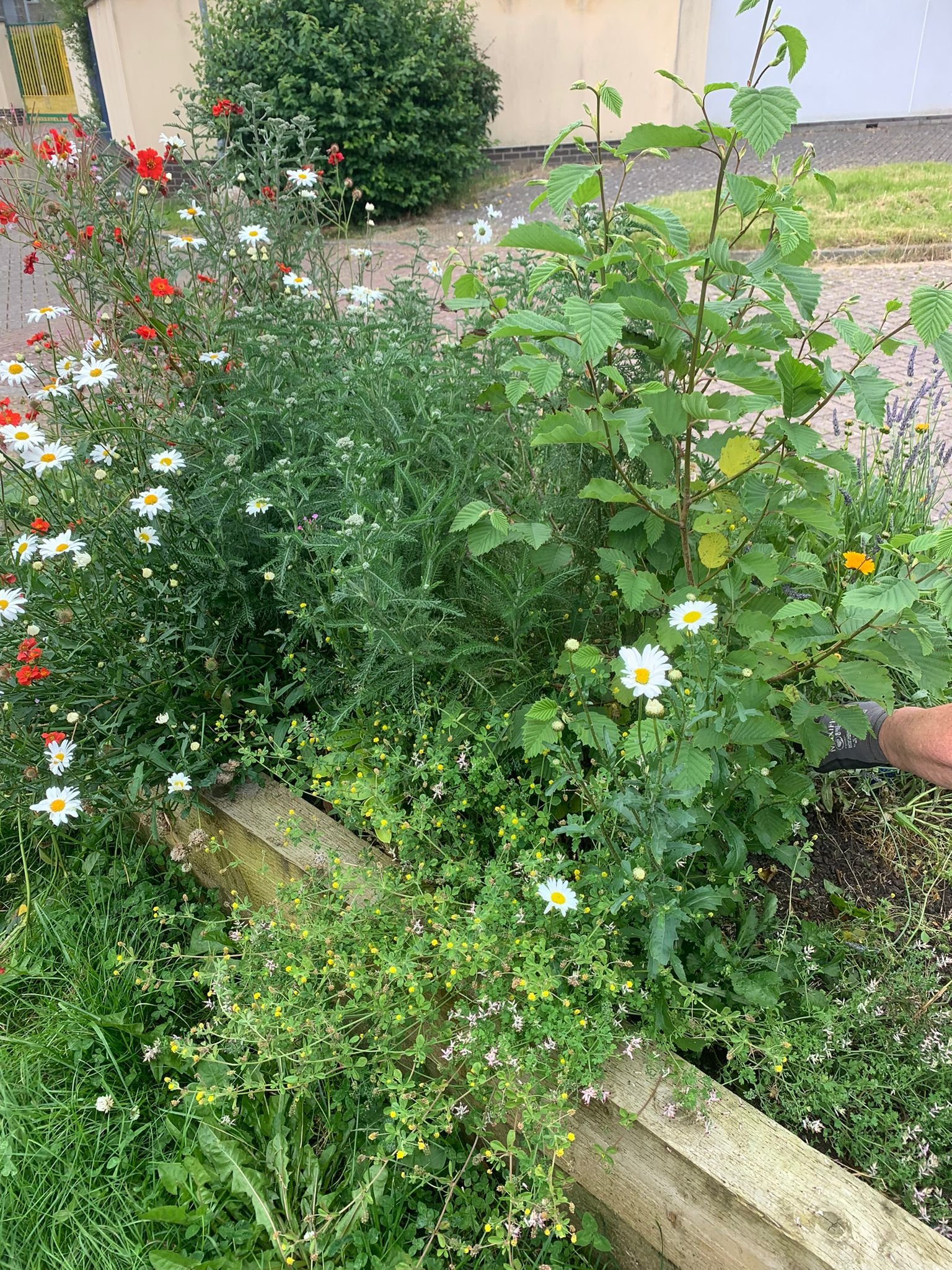
Care home wetland programme
Over the past year, we have made a concerted effort to reach out to individuals who have cherished the river for decades but can no longer visit independently.
Our team spent countless hours at various care homes and outreach centers, listening to the residents' treasured stories about the river. Through engaging workshops, these residents actively contributed to our wetland program via a gardening initiative. This allowed them to plant seeds that will grow into wetland plants, helping to protect the river's future and ensuring their legacy endures.

River Rapping workshops
To engage the youth of the Maesgeirchion estate, we sought a medium that would truly capture their interest. We found this in local rapper Gent Orange, a rising star in the community. Gent Orange led a series of dynamic workshops, using spoken word and lyrical expression to connect with local youths. These workshops, held at the river, provided an innovative and inspiring way to foster a deeper appreciation and connection to our freshwater habitats.

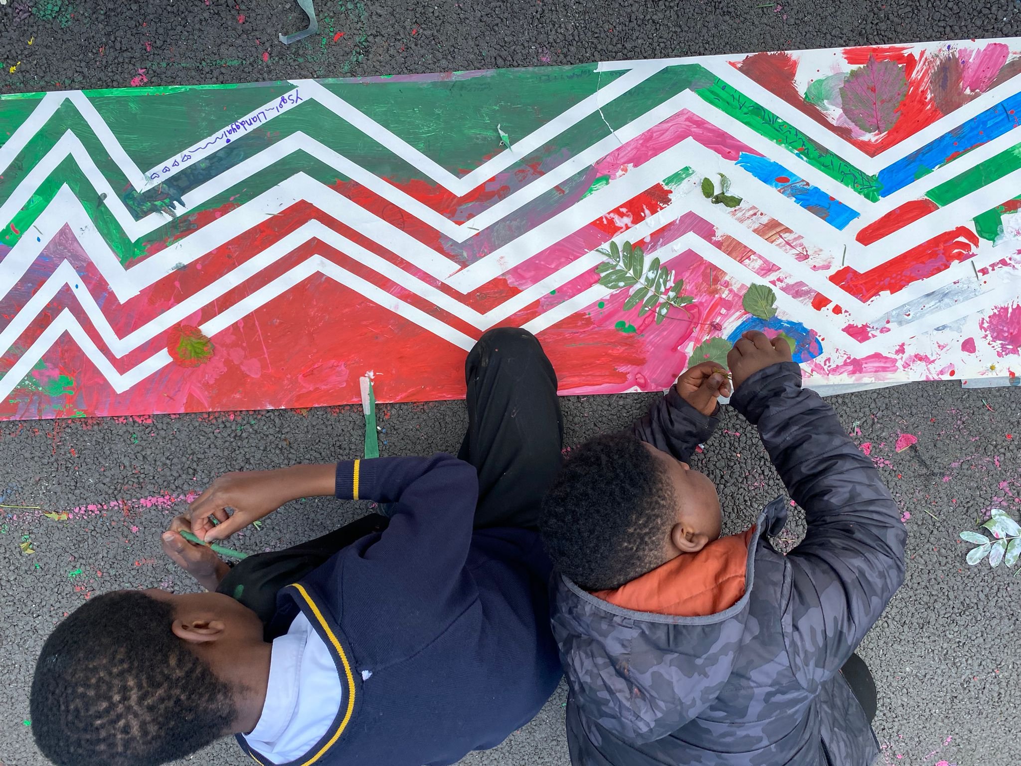
A River of Art: From Uplands to the Sea
Students from three different schools—stretching from the uplands to the sea—collaborated to create a continuous piece of artwork that embodies their deep connection to the river.
This "art river" grew longer with each school's contribution, capturing the roots and heritage of the river as well as the students' hopes for its future. As this vibrant artwork journeyed through the catchment, it expanded, accumulating meters of ideas and reflections from young minds throughout the region.
The result was a visual narrative that showcased a collective vision for the river’s future, weaving together the dreams and aspirations of the entire catchment of the Afon Cegin.

Intergenerational Mapping
We have used the term ‘Intergenerational mapping’ to refer to the process of documenting and analysing the knowledge, experiences, and perspectives of different generations within the Afon Cegin and surrounding community. This has allowed us to capture how various generations interact with, influence, and pass down information and traditions over time about life on and around the river and their communities.
Intergenerational mapping has been a powerful tool for bridging the gap between past and present, ensuring that both historical knowledge and contemporary insights contribute to a sustainable future.


Achieving Inclusivity in Environmental Advocacy
We recognise the importance of diverse perspectives in tackling environmental challenges and advancing social justice.
However, the environmental movement continues to face significant diversity challenges. A 2017 report from the Policy Exchange revealed that only 3.1% of UK environment professionals identified as Black, Asian, or Minority Ethnic (BAME), compared to 12.6% across all professions. Similarly, a 2020 survey by the Chartered Institute of Ecology and Environmental Management (CIEEM) found that less than 1% of its members identified as Black.
Our DEI lead Famke is currently conducting a barriers study amongst rural and coastal communities in North Wales, engaging in focus groups and interviews with people from minority backgrounds and people facing limited opportunities through disability and ill health. Our findings aim to shed light on these challenges and encourage dialogue among various communities and organisations involved in this vital work.
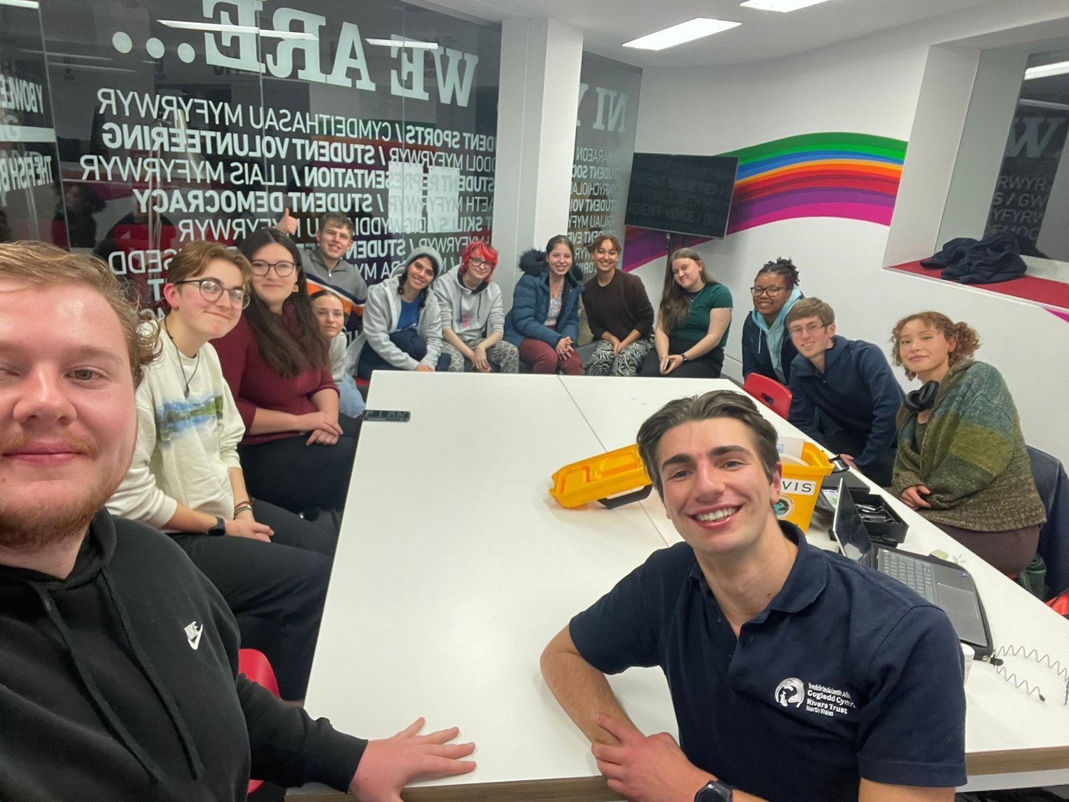
Upskilling the community
As part of this project, we aimed to empower community members in rural areas by organising a training day to enhance their skills. Participants learned how to identify pollution, conduct chemical testing, study invertebrates, campaign for environmental causes, and perform river habitat surveys. This initiative equipped them with the knowledge and tools to actively protect and preserve their local waterways. Logging and mapping the data so we can target high risk areas and lost habitat.

‘A collaborative effort is needed to tackle environmental issues, for this, we need to improve sense of belonging in green spaces for everyone.
It is well known that nature can have a positive impact on wellbeing, many social issues including mental health could be improved by engaging marginalised people in nature based work.’
Famke DEI Lead officer


Are Roots the answer?
At The North Wales Rivers Trust, we are exploring natural solutions to alleviate flooding and improve water quality in North Wales.
By leveraging the power of root systems, we aim to address these critical environmental challenges.

As part of this project, we have been engaging with farmers, listening to their experiences, and discussing the changes they have observed in these upland landscapes over the years. These farmers face significant financial challenges and external pressures, making their work increasingly difficult. Issues such as flooding and drought exacerbate these problems, highlighting the need for sustainable solutions.
By working together, we aim to co-develop strategies that balance agricultural productivity with ecological sustainability, ensuring a prosperous future for both the farmers and the environment
Uplands
The uplands of Snowdonia, with their dramatic landscapes and rich biodiversity, play a pivotal role in the health of downstream rivers.
However, these uplands have faced significant ecological stress due to overgrazing and soil compaction, which disrupts their ability to retain water. Addressing these issues is crucial for enhancing river health.
Overgrazed lands lose vegetation cover, leading to soil erosion and increased runoff, which carries sediments and pollutants into rivers.
Compacted soils further exacerbate this problem by reducing infiltration rates, leading to flash floods and decreased water quality.
By restoring these upland areas, we can improve their capacity to hold water, mitigate flooding, and ensure cleaner, more stable river systems. Implementing sustainable land management practices, such as controlled grazing and rewilding, can help rejuvenate these vital upland ecosystems, benefiting both the local environment and downstream water bodies.
Eryri upland farmer Elfed explains some of the issues he is facing:
We are focused on working with scientists and farmers to map key areas where a combination of wetland, riparian and herbal ley planting can help to improve soil health for farmers and increase flooding lag time. Offline pond retentions schemes and leaky dam pilots. We are also moving out biochar feasibility report into ta community based circular economy to collect diffuse pollution in riparian zones and redistribute it on to soils.
Pilot Rainscapes Project
in River Communities: A Sponge Cities Approach
As climate change intensifies, we are facing increasing challenges with water management, especially along river communities where flooding and water scarcity are frequent issues. Traditional infrastructure is often insufficient to cope with these extremes, prompting the need for innovative, sustainable solutions. In response, we are launching a Pilot Rainscapes Project that draws inspiration from the principles of sponge cities, adapting these concepts to a smaller, community-focused scale.
This project will serve as a model for other riverine areas, demonstrating how small-scale, community-driven initiatives can contribute to larger environmental goals. Through collaborative planning, education, and innovative design, the Pilot Rainscapes Project aspires to transform river communities into thriving, adaptive, and water-sensitive environments.
So far we have:-
Engaged allotments along the river systems to grow wetland plants ready for our SUDS planting.
Worked with gardening groups on the Maesgeirchion estate to listen to their ideas for where raingardens might be best placed and plant up existing planters.
Met with Dwr Cymru on site to discuss SUDS potential
Delivered a series of care home wetland programs across the network to engage everyone in the fight to protect our rivers.
Worked with a local artist to design an educational SUDS structure to engage the Maegeirchion estate with water care.
Developing a model to allow communities to implement SUDS with a water bill reduction on their bill similar to global models.

SUDS DESIGN
Many small-scale interventions will also be integrated within wider landscape improvements, including informal play features and revitalised community garden spaces incorporating ornamental and fruit trees and raised planters, with the aim of reducing pressure on the existing surface water drainage networks across the estate.
A summary of these small-scale interventions are as follows:
*142m2 of biodiverse green roofs installed as source control on bins stores and pram sheds.
* Unused hard landscaping areas replaced with permeable landscape features including rain gardens, stony basins, permeable paving, composite decking and ‘schotterrasen’ (Austrian gravel lawns).
* Pebble or vegetated channels diverting run-off from downpipes to shallow basins/rain gardens and swales planted with wildflowers.
*Vertical rain garden irrigated by water collected from building roofs which is fed into raised planters containing climbing plants.
* Conversion of a 20m2 strip of unused space into a combined rain garden and SuDS tree pit
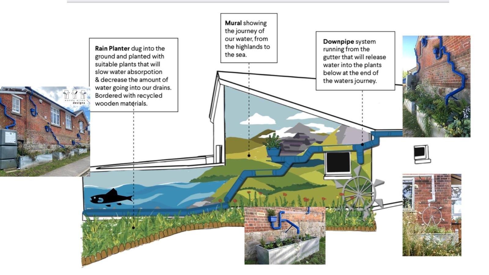
The below design by local artist Aliss Curtis seeks to use a key building within the Maegeirchion estate to engage the community in Rainscapes. Based on the work being done at the ARK trust and with Wendy Allen we have devised a series of engaging water routes to demonstrate the journey from source to sea.
Phase 2: We are currently discussing options for placement with the local housing association and council and seeking out planning permissions for a potential mural and rain scapes sytem.
The final design will incorporate water slides, planters, water wheels, creative pipe work and soil health systems.


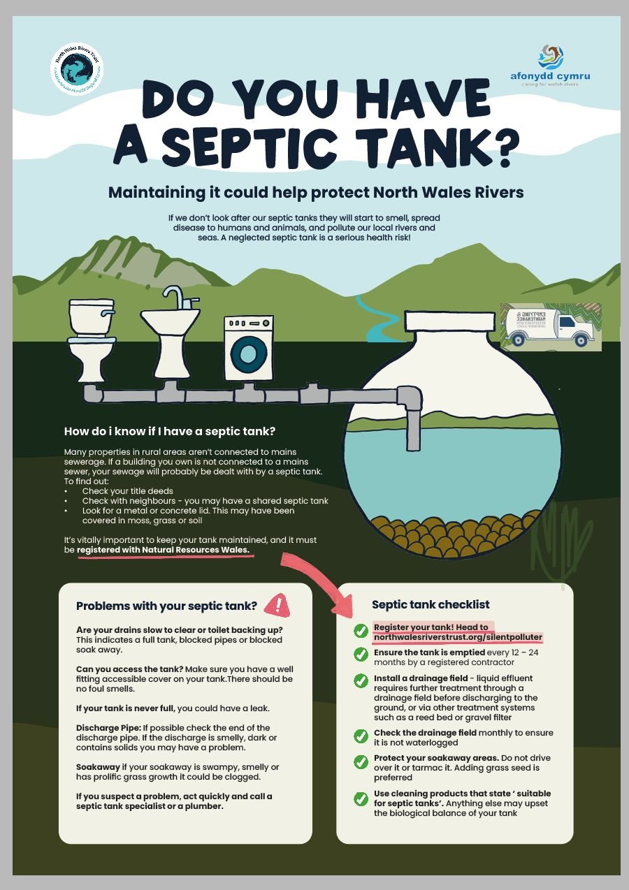
Across the catchment we have launched a bilingual Silent Polluter campaign. This campaign involved a series of door to door and on foot discussions with the public from the uplands to the sea.
The campaigns aims to empower individuals and communities to get educated on their home waste water treatement.
The campaign included:
1) Septic tank check list for upland communities to ensure they are registered and maintained
2) Educated homeowners and renters on how to spot misconnections.
3) Educated the public on the impact of the chemicals they put down their drains.

Silent Polluter Campaign
Rain Relief
We are initiating a comprehensive study to explore the feasibility of introducing a "rain relief" stormwater incentive for communities that implement Sustainable Drainage Systems (SuDS).
Drawing on successful global examples, such as the stormwater fee credit programs in the United States and Germany, we aim to encourage the adoption of SUDS by offering financial incentives. We are currently liaising with relevant organisations and communities to look at how and where we can implement a test case pilot study that could be rolled out across Wales. Plus potential grants to implement the scheme.
The program will work by:
Reduced Fees: Property owners who implement green infrastructure reduce their stormwater fees, resulting in direct financial savings.
Lower Infrastructure Costs: By managing stormwater on-site, the communityreduces the need for expensive upgrades to stormwater drainage systems.
In partnership with the council, landowners, community members, organisations and individuals such as James, we were able to secure funding from WCVA and LNP Cymru to install a pan Wales wetland pilot study. This includes:-
332 square metre wetland with additional upstream farming interventions to reduce diffuse run off from agriculture.
332 metre wetland in another lake with no additional interventions.
One control lake
This study will enable us to study the impact and feasibility of wetlands across Wales.


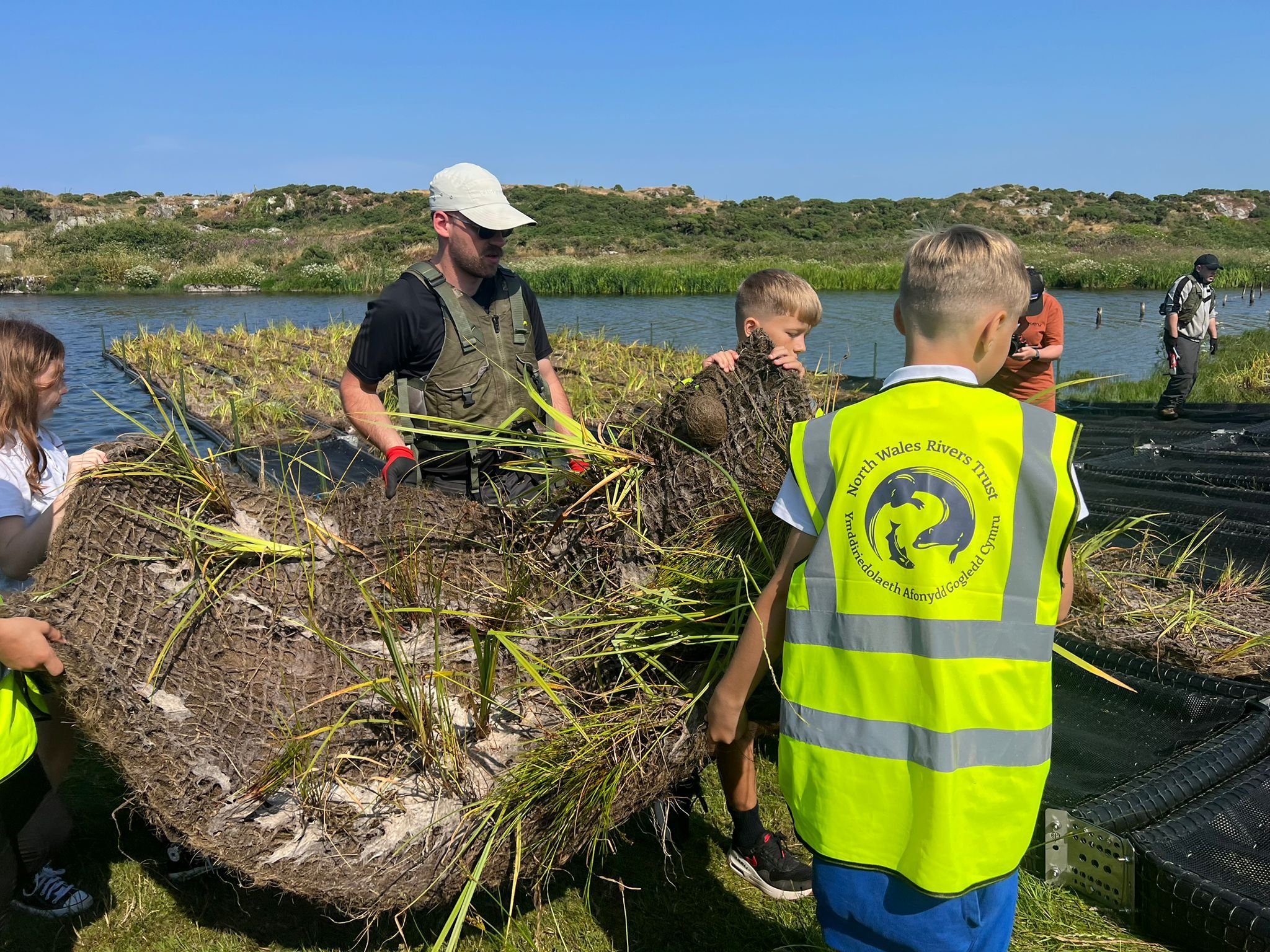
As part of a pilot program, we worked with teachers, educators, and students in North Wales schools to help them create their very own floating wetlands! Developed in partnership with the LNP Grant and support from the Welsh government for capital the STEAM Activity Kit provides a hands-on opportunity to learn about the Floating Wetland project. Inclusing ecology, pollution, and water quality. This booklet, created for a four week class for grades 3-6, includes lessons and activities that fit within a one-hour period.
Activity Kits explore the lifecycle of daphnia and show changes in water when daphnia, spirulina, and a wetland are present in the same environment!
The Role of Biofilm in Floating Wetlands
Biofilm is a crucial component of the functioning of floating wetlands, significantly enhancing their ability to filter and purify water. Biofilm consists of a complex aggregation of microorganisms, including bacteria, fungi, algae, and protozoa, which adhere to surfaces submerged in water. In floating wetlands, biofilm forms on the roots of the wetland plants and the surfaces of the floating platform.
How Biofilm Works in Floating Wetlands:
Formation and Composition:
Nutrient and Pollutant Breakdown:
Surface Area and Habitat:
Synergistic Relationships:
Benefits of Biofilm in Floating Wetlands
Enhanced Water Quality: By breaking down pollutants and absorbing excess nutrients, biofilms significantly improve water quality.
Resilience and Efficiency: Biofilms are resilient and can adapt to varying environmental conditions, making floating wetlands effective in diverse aquatic environments.
Biodiversity: Biofilms contribute to the overall biodiversity of the ecosystem, supporting a variety of microbial life and providing food for higher trophic levels, such as aquatic invertebrates and fish.
We are hoping to secure further funding to analyse the scientific data and continue the community collaboration works in order to fully understand the full benefits of these wetland eco systems
Floating Wetlands
The North Wales River Trust Floating Wetland explores an ecological intervention to reduce harmful algal blooms in lakes, which threaten the water quality and wildlife as well as recreation opportunities.
Reducing nutrient pollution from reaching the lake remains a vital method for preventing blooms, but this approach depends on increasingly complex upland solutions. We are currently working with landowners to co design a series of interventions up stream as part of our pilot.
In-lake interventions like floating wetlands offer a complementary strategy that can absorb and remove nutrients from the water, increase biodiversity, support local ecological changes, and provide other co-benefits, like additional green space.
Alongside our roots work we are working on the feasibility of a series of circular economy interventions that could generate funds whilst also improving water quality.
Circular Economy
Bio Char in the uplands- Looking at community led project to create bio char, use it in riparian zones to collect run off pollution from fertilizers and re distribute the bio char to improve soil health. There is also an opportunity for the community to generate funds through this initiative.
RiWet- Mapping potential interventions for wetlands in the lowlands, around CSO sites and riparian zones. Although NRW have taken the stance that they will not approve wetlands for water regulation treatment we believe there is dual benefit for biodiversity, habitat and water quality.
Watershed Blueprint.
A catchment based approach. We are currently working on a detailed and collaborative co-designed plan for managing and protecting water resources within these watersheds, much like a blueprint provides a comprehensive guide for construction projects. It emphasises the structured and strategic approach to watershed planning.
The full watershed blueprint will be printed here in due course. Through community discussion and engaging a wider group of people in our ideas mapping we would like to explore further circular community economies and gaining river rights for the river. This will give the river legal rights and the power to protect itself from polluters and connect the entire communities along its length to work together to protect their communities, willdife and the river.