
Reviving Fish Spawning Grounds
Reviving Fish Spawning Grounds: A Data-Driven River Restoration Project

Aerial image of a small section of the river.
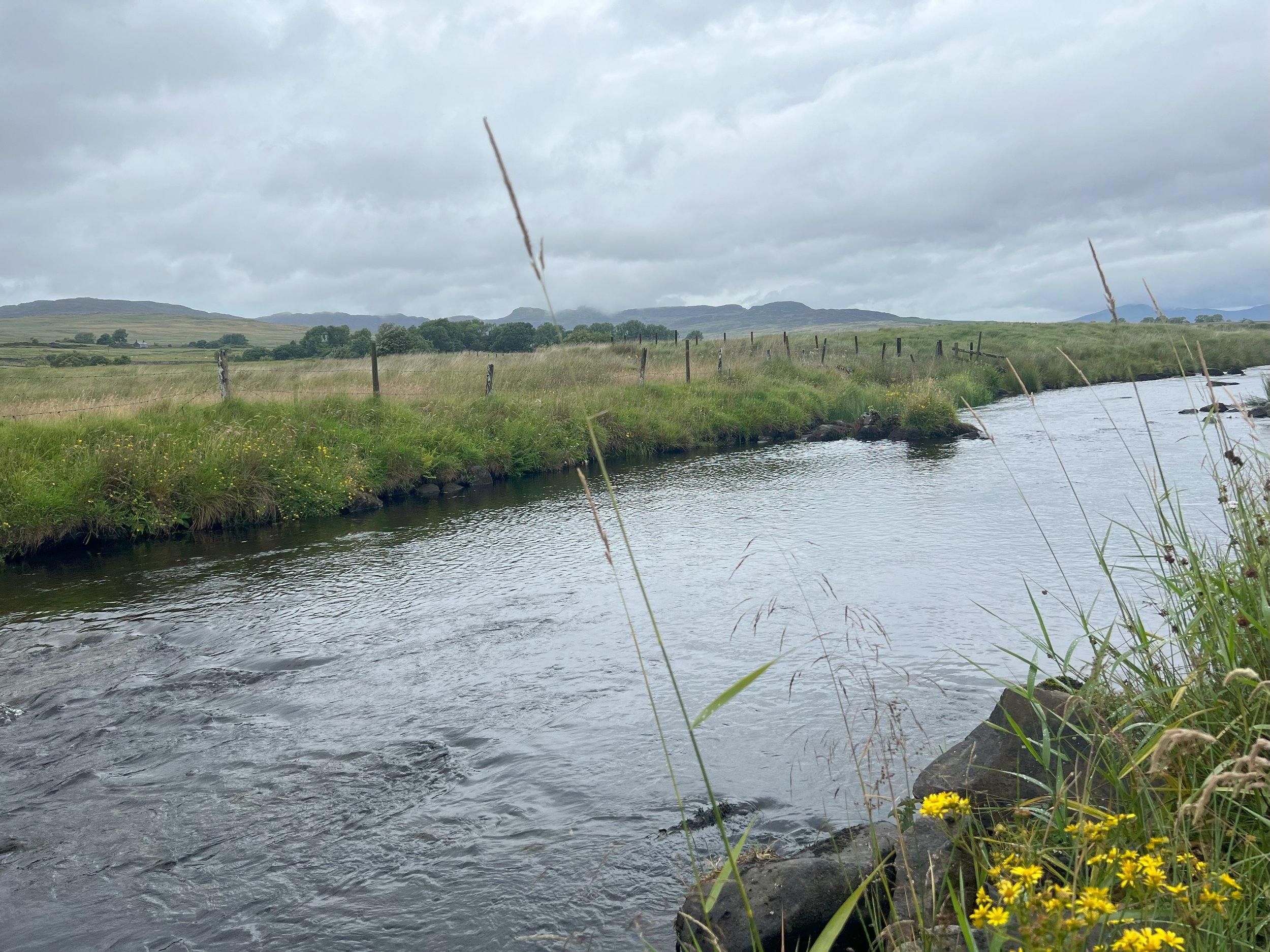
On the Mawddach River, we've been working throughout the year to restore critical fish spawning habitats in a designated Special Area of Conservation (SAC) and Site of Special Scientific Interest (SSSI). This location, renowned for its freshwater pearl mussels, floating plantain, otters, marsh grass, and salmon, faced a grim reality – all were in unsatisfactory conditions. Our mission?To prioritise and execute habitat improvement, water quality enhancement, and the restoration of spawning grounds to support all of these species.

Freshwater Pearl Mussel Survey- August 2023
Initial site Morph assessment revealed cannelised sections, historically dredged boulders, and compacted gravels. Open grazing by cattle inflicted damage on potential spawning grounds and protective grasses. Exposed river bank had led to aggressive plant weed growth on the river bank and heavily compacted gravels.

Example of poached river bank prior to fencing.

Excessive pondweed growth in exposed sections.
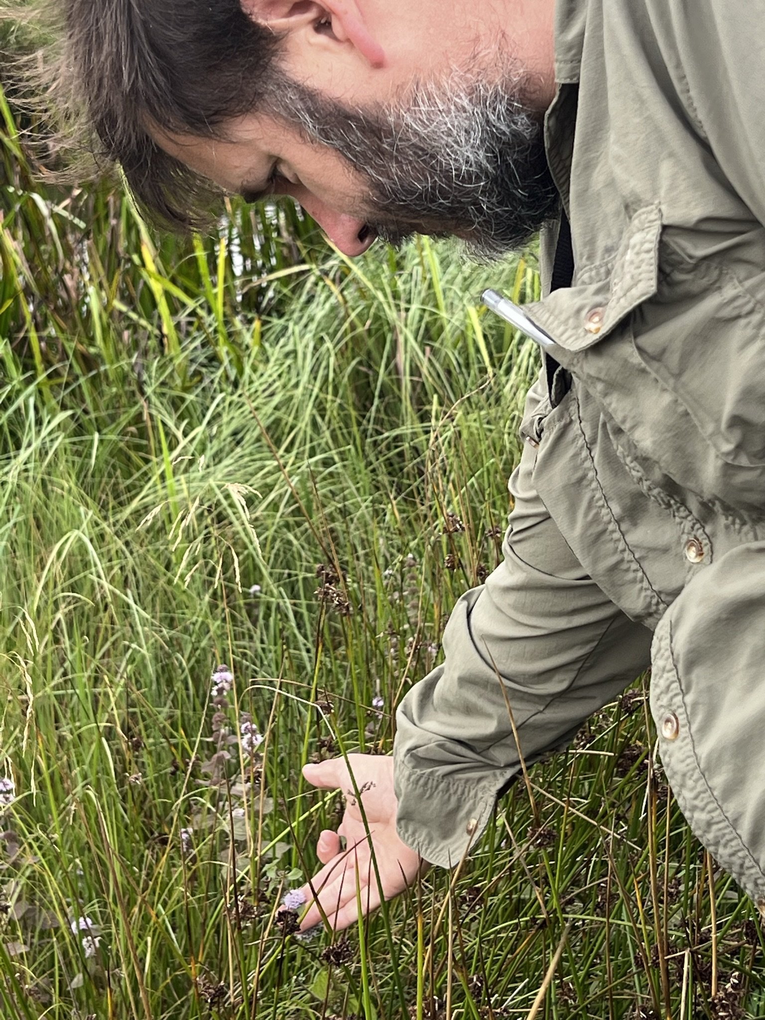
On site walkover with NRW Freshwater Pearl Mussel Ecologist Thomas Doherty Bone
Restoration
Beginning in January, amid challenging weather conditions, we took action to improve this section of river. We erected over 1600 meters of riverbank fencing, creating a 10-meter buffer zone to keep livestock out, curbing poaching, and establishing a continuous riparian corridor.
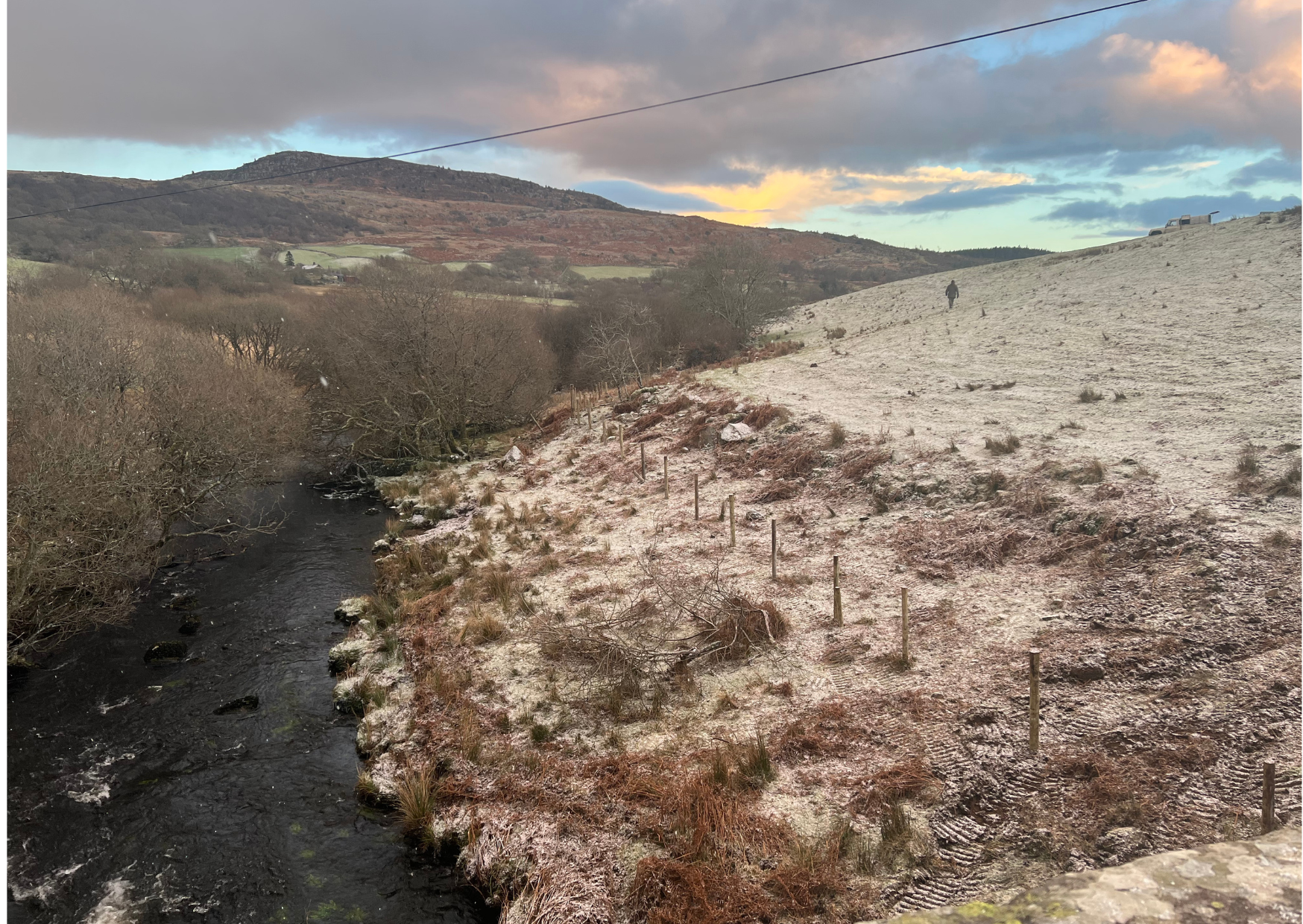
Fencing during a blizzard to create a riparian corridor in January 2023
Our second phase involved thorough snorkel surveys, riparian corridor assessments, and water quality testing. This scientific groundwork provided a baseline for habitat and wildlife assessment, supported by GIS mapping of drainage ditches, peatland, and SSSI grasslands.


Freshwater Pearl Mussels were identified and carefully mapped to ensure minimal disruption.
Expanding our efforts, we fortified fencing to protect SSSI grasses for a further 1000km. Additional improvements included trough installation and solar pumps with hard standing. This allowed cattle to be kept from the main river and prevent poaching of the banks resulting in less sediment smothering spawning gravels.

New concrete cattle troughs, hard standing and solar pumps to provide an alternate water source for cattle.
During site surveys we identified two potential sites to improve spawning gravels. The potential sites had both compacted gravels that needed aeration. This will be carried out next week by hand with Trust volunteers, using simple methods and tools to lift gravels in order to aerate and release potential spawning gravels. Allowing fish to lay eggs amongst the gravel. In other areas we noted historically dredged boulders. We reintroduced these back to the channel. The boulders will provide a variation of flow, deeper pools through scour and cover from predation. We followed this up by adding 100 tons of river-rounded gravels on top of the boulders. These not only acted as anchors to secure the boulders in situ but as new potential spawning gravels.

Boulders being placed back into the channel.

Gravels placed ready to be placed throughout this previously dredged section.

The following day river rounded gravels were added to secure the boulders and provide substrate.
These interventions served to oxygenate the water, improve flow, and provide crucial spawning substrates for fish.

The next phase will include tree planting.
The next phase will witness the planting of over 1000 deciduous trees along a 2.5-acre stretch of the riverbank. The majority of these trees will use a pollarding technique from the existing willow, sessile oak. These will be combined with other deciduous plants such as the Common Alder. These trees, notably beneficial to fish species such as salmon, contribute to temperature regulation in the river, maintaining an optimal environment. They will also help shade sections of the river reducing invasive pondweed growth throughout the river. Over the long term trees will provide woody debris to the water course acting as protection for fish at all life stages.

Ditches entering the river.
During the next phase we are hoping to reconfigure two riverbanks to reconnect them with the floodplain. This will reduce the impact of flow on spawning gravels and boulders by reconnecting the river to the floodplain and reducing the velocity and flow in high rainfall. We hope to combine this with ditch blocking to prevent sediment smothering fish habitats.

AFTER: You can see the wetland forming in the riparian zone- this helps to control flow and filter diffuse pollution.
We have also initiated a comprehensive mapping and monitoring program for the outflow originating from nearby septic tanks and a sewage discharge point. Any identified issues from either source will be addressed with the water board, with a primary focus on permit levels and regulation and implementing flow monitoring, particularly during low-flow periods.
In addition, we are developing and putting into action a plan to establish polishing wetlands around each outfall, enhancing the natural water purification process. Simultaneously, we are actively raising awareness about the importance of regular septic tank maintenance and proper emptying procedures among the community. Our commitment to water quality extends further with the implementation of our chemical analysis program, ensuring no harmful leaching occurs into the waterway.
Furthermore, our scope of water quality analysis will encompass the detection of freshwater pipe leaks. This is especially crucial due to the elevated phosphate levels in the area and the potential correlation between phosphate concentration and the proliferation of pondweed growth. By identifying and addressing these issues, we aim to safeguard the integrity of our waterways for the benefit of both the environment and the community.
BEFORE: Cannelised section of river that has historically been dredged.
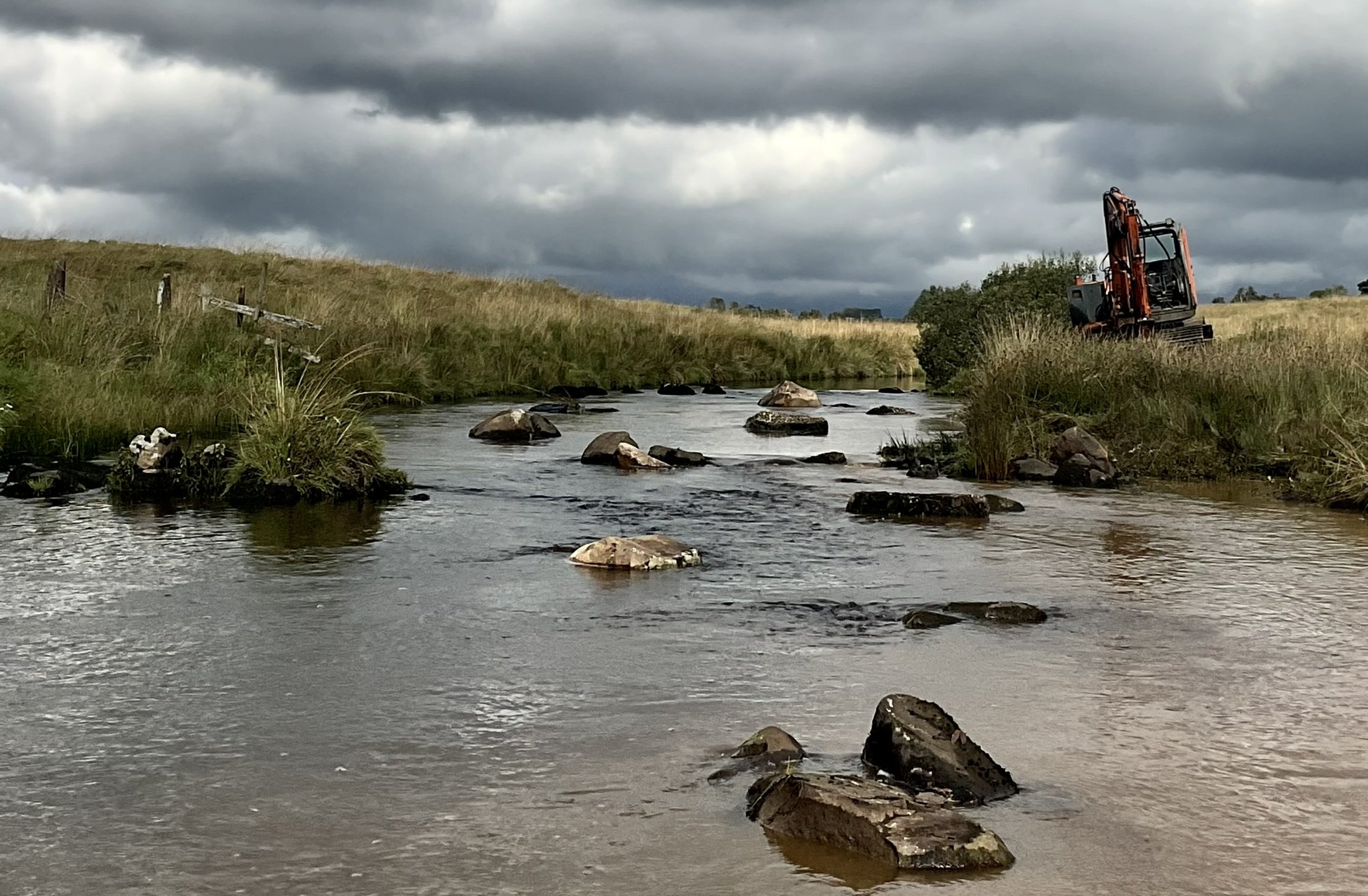
AFTER: Dredged boulders being returned to the channel with 100 tons of gravel.
This ambitious project became possible thanks to fisheries funding from Natural Resources Wales. Our commitment is grounded in tangible outcomes. As we progress, stay tuned for factual updates, data-driven insights, and the concrete impact of our efforts. The aim is to restore the Afon Eden on the Mawddach River ecosystem, ensuring its sustainability for future generations.